A network of city airports linked like an aerial subway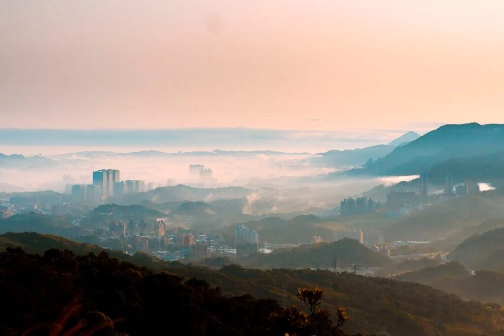
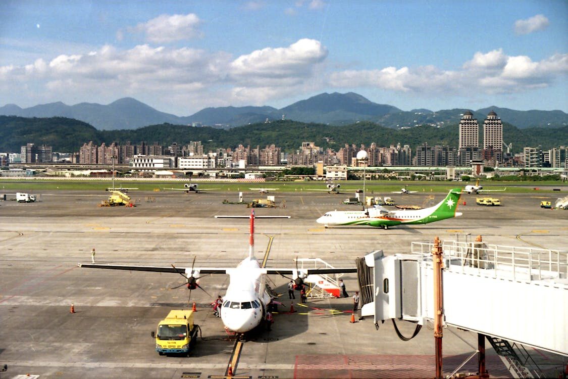
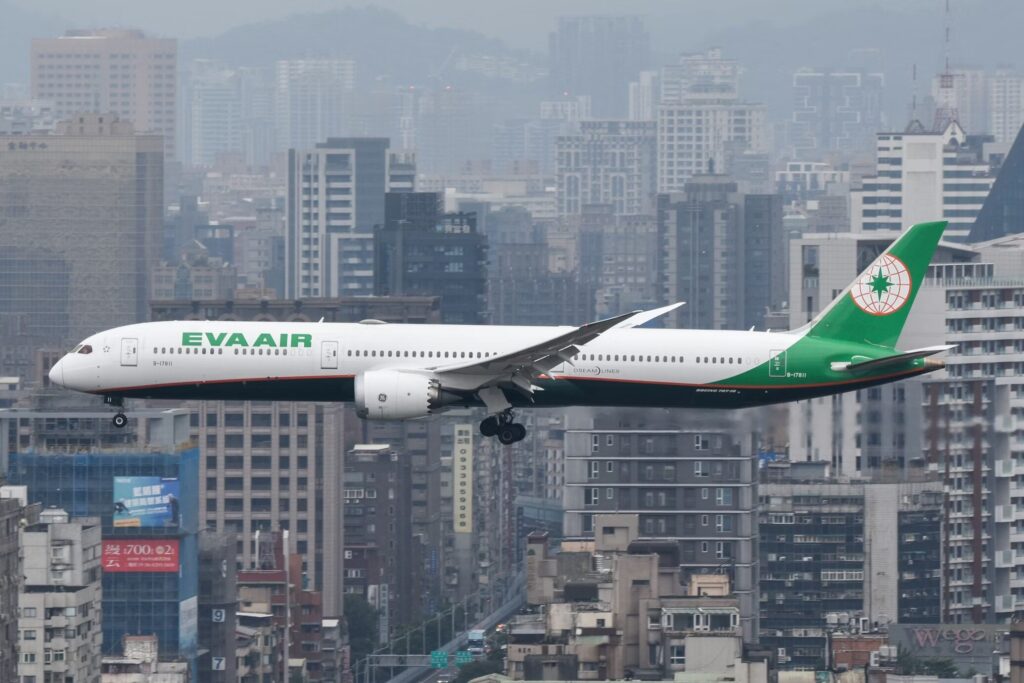
I sit by the window in the departure lobby of Taipei Songshan Airport. Beyond the glass, aircraft from Japanese carriers line up, and between them appear the tails of China Eastern Airlines and Korean Air, their familiar color schemes standing almost the same distance apart. Looking at the destinations of the departing flights, they are all cities reached in about three hours, and none of them lie on the outskirts. Each arrival point is an airport that still sits inside the urban core.
Tokyo’s Haneda Airport. Seoul’s Gimpo Airport. Shanghai’s Hongqiao Airport. And Taipei’s Songshan Airport. When these four points are connected, a diamond-shaped route emerges across the map. It forms an aviation network that links the centers of Northeast Asia’s major cities directly to one another. This is what is called the Golden Flight Circle.
Borders remain, and passports are still required. Yet in sensation it feels less like international travel and more like riding a subway line. One boards in the center of a city and steps off in the center of another. Movement across the sky begins to resemble a route map drawn above the streets, and in this region such motion has become routine.
The Shared Past of Displaced Airports
The four airports that shape this circle share a curious history. Each was once pushed aside from its role as the main gateway. Haneda lost its international flights with the completion of Narita. Gimpo yielded its position when Incheon International Airport opened. Hongqiao became secondary as Pudong grew into a massive hub. Songshan also surrendered most international routes as Taoyuan expanded.
From the 1970s through the 1990s, these airports were gradually downgraded to primarily domestic use. It was an era when space and future expansion mattered more than proximity to the city. But the cities kept spreading outward. Travel time to suburban hubs lengthened, and the distance from the center began to feel heavier.
At that point, the former “old airports” drew attention again. They already had runways and were already woven into urban life. To counter the dominance of large suburban hubs, these central airports began linking directly to one another. It was a form of alliance among the displaced, built on the value of distance. The Golden Flight Circle became a quiet revival of infrastructure that had once been set aside.
The Political Timing of 2010
The four points fully connected in 2010. Before that, routes between Haneda and Gimpo, and Haneda and Hongqiao, had gradually resumed. Only Songshan remained disconnected. Relations between Taiwan and China had long obstructed the expansion of direct flights.
The turning point came with the Ma Ying-jeou administration. As cross-strait relations softened, direct connections with the mainland were opened. Almost simultaneously, Haneda’s re-internationalization progressed. In October 2010, Haneda returned as a full-scale international hub.
Along with that shift, routes between Songshan and Hongqiao, and Songshan and Haneda, were launched one after another. Cities that had been isolated points suddenly became linked by lines. Taipei returned to the functional center of Northeast Asia’s economic sphere, not on a map but through runways and timetables.
A Corridor Filled with Suits
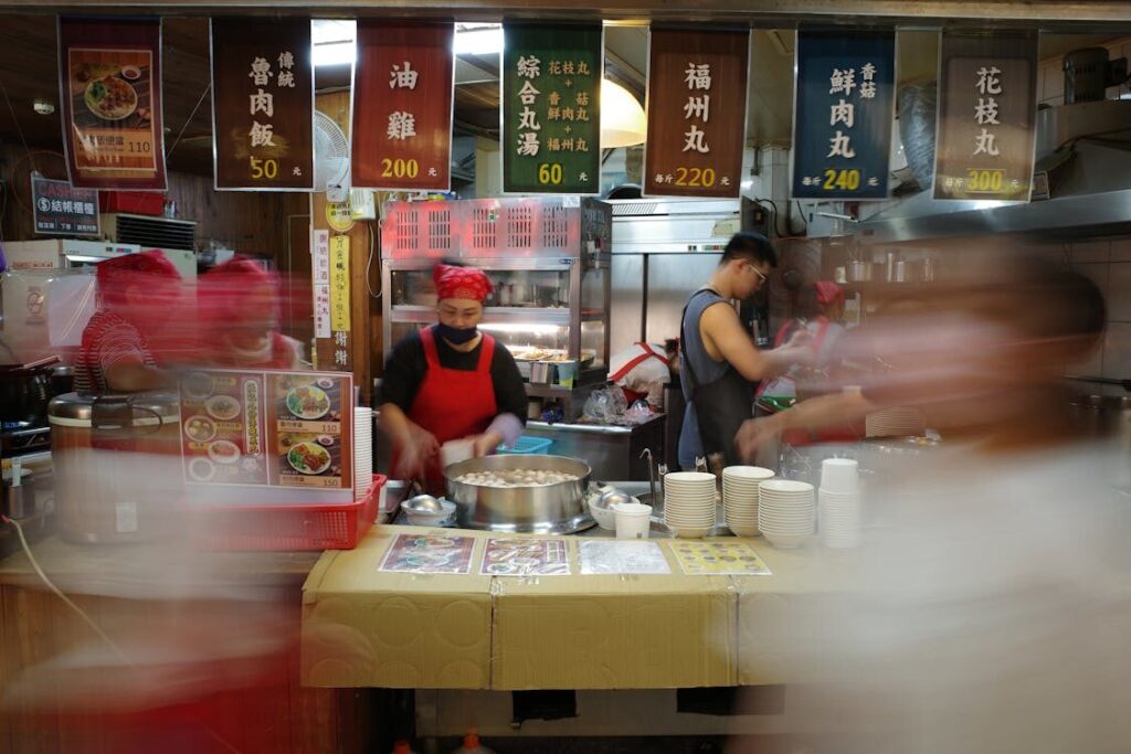
The departure lobby at Taoyuan International Airport is crowded with backpackers and tour groups. The gates at Songshan present a different scene. Most seats are occupied by passengers in business suits. Laptops rest on knees. Documents remain open even as boarding announcements sound.
The people on these routes are not traveling for leisure. They are compressing time. A flight leaves Songshan at nine in the morning and arrives at Haneda shortly after noon. Meetings fill the afternoon. By evening, the return journey begins, and by night the traveler is back in Taipei.
The distance covered is international, but the sensation is closer to commuting. The airport functions less as a tourist gateway and more as a high-speed corridor between cities. This rhythm is possible because city airports are connected directly. Passing through suburban hubs would dissolve this density. The Golden Flight Circle circulates quietly as the bloodstream of Northeast Asian business.
The Vast Empty Space Left in the City
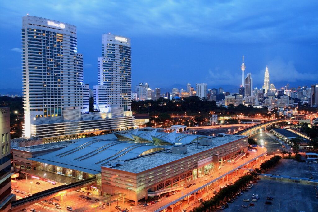
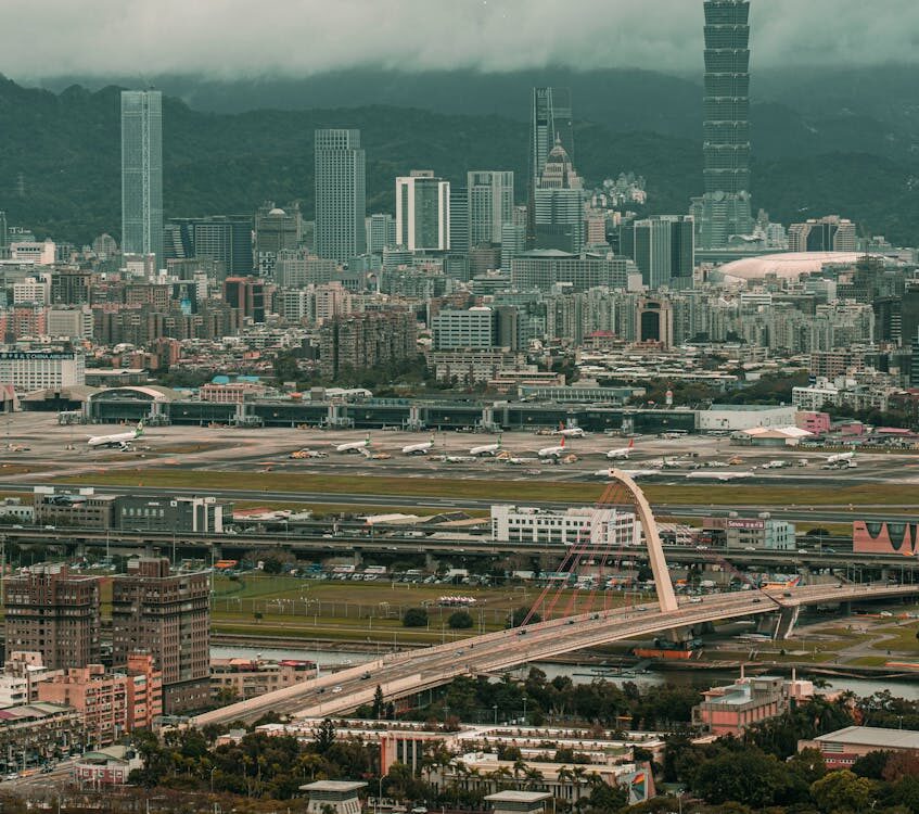
The grounds of Taipei Songshan Airport cover roughly 213 hectares. In the center of Taipei, few parcels of land of this size remain intact. Compared with Daan Forest Park, it equals about eight of them. From above, the city’s density visibly breaks where the runway cuts straight through the urban fabric.
If redeveloped, the site could become a massive urban park or an extension of the financial district like Xinyi. Each election cycle, proposals to relocate the airport resurface, fueled by the view that this is an extravagant use of central land. From a purely economic perspective, the logic of keeping a runway here appears thin.
The Invisible Limits Created by Air Routes
The cost of the airport is not confined to its footprint. Strict height restrictions apply to Zhongshan and Songshan districts beneath the flight paths. Buildings cannot rise beyond set limits. As a result, older apartment blocks remain, because redevelopment cannot fully utilize the land’s potential.
Taipei’s skyline dips unnaturally in certain areas. This is not a matter of design but the outcome of preserving aerial corridors. The city has surrendered not only surface land but also vertical growth. In exchange, it sustains a short-distance aviation network that cuts across the region.
Choosing Time Over Land
Despite these pressures, closure does not proceed. Successive administrations ultimately weigh another value more heavily than redevelopment profit. The ability to travel round-trip to major Northeast Asian cities within a day.
This single function is treated as more competitive than new towers or commercial zones. When global firms consider where to base Asian operations, or when investors plan frequent visits, shorter travel time becomes easier decision-making. Proximity to Haneda, Hongqiao, and Gimpo supports Taipei through time rather than terrain. The city appears to have chosen speed of movement over real estate yield.
Dividing Roles with the Suburban Hub
Taiwan’s aviation strategy does not rely solely on Songshan. Taoyuan International Airport sits outside the city and carries long-haul routes and mass transit. Flights to Europe and North America gather there. Low-cost carriers operate there. It functions as a transfer hub designed to move large numbers cheaply and far.
Songshan serves the opposite purpose. It specializes in short distances and efficiency. It links nearby capitals quickly and frequently, operating like a shuttle across Northeast Asia. Within one country, two entirely different types of airports coexist.
Fares from Songshan are often higher than those from Taoyuan, yet occupancy remains steady. Passengers accept the premium for time saved. Taiwan’s airspace is organized by distance, each airport fulfilling a distinct role.
A Runway Placed at the Center of a Dense Economic Zone
Within a radius of two thousand kilometers lie Tokyo, Seoul, Shanghai, and Taipei. Population, economic power, and political authority concentrate tightly within this zone, a density rare on a global scale. Taipei sits near its center.
Songshan’s runway is not long, and beside major hubs it seems modest. Yet the cities it connects carry weight. Places where power, capital, and decisions gather are linked at everyday distances.
From the terminal windows, aircraft continue lining up in quiet repetition. In the heart of Taipei, the aerial corridor remains in use, threading the city into the dense fabric of Northeast Asia, unchanged today.